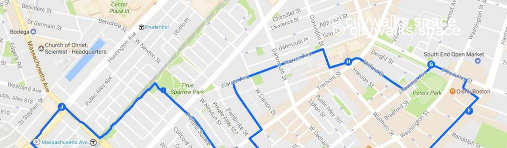
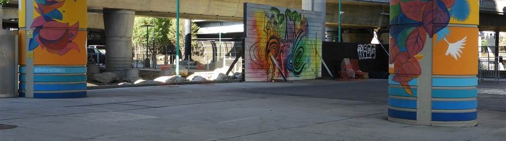
Walk in Boston # 15, the gardens of the South End, is a 3 miles self-guided tour to discover the South End, its Victorian-style houses, its art galleries and its countless public parks and communal gardens. At point F, you can add about 1/2 mile each way to visit Underground at Ink Block and Channel Park, big murals painted under the Highway 93 bridges. The place is very noisy but surprising.
The walk will take you about 2 hours to complete, more if you go and see the murals. You’ll walk through historic streets, discover an European style cathedral, visit artists’ studios and get an idea of what the locals are growing in their small gardens.
This walk is now only available on Payhip in pdf format with a clickable map and updated descriptions.
In this pdf you will also find:
- the list of Highlights.
- the Metro stops to get there and back and infos for Buses.
- tips about restrooms, places to sit and eat.
- details about a particular place you will find on your route.
You can download it (or just the map of the walk) to your phone to help you in your discoveries.
This will allow you to live a unique experience of the city far from what you might find elsewhere.
If you purchased the Boston NYC book, this download will be free for you, just send me a note for an access code for this walk if you don’t have it already.
The description below, incomplete and with cropped photos, gives you an idea of this walk before you decide to buy it.
A: Like for Walk in Boston # 16, from Symphony to Brigham Circle, this walk starts at the …T.stop but this time, you’ll go east.
Take …to reach … on your left.
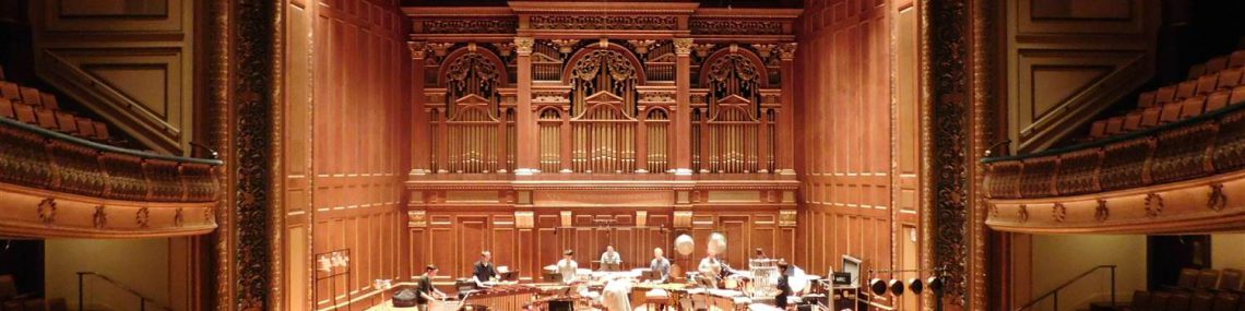
B: You’ll find your first stop there, ….
It’s a perfect acoustic concert hall, listed as a historic monument. Ask the guards at the entrance if you can go and visit it. With a little bit of luck, you may even hear … students rehearsing on stage.
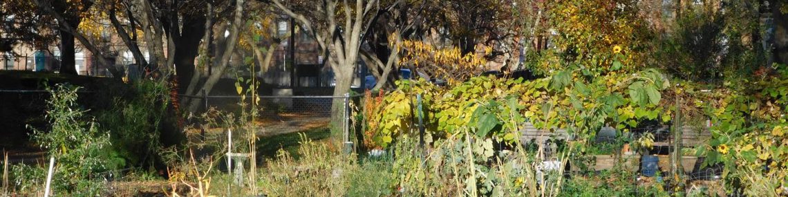
Next, continue on … and take a … over the railroad to enter the South End. You’ll soon see a communal garden. It’s going to be the first of a long list as the South End is known, among other things, for its gardens and its parks.
Turn left into this park and once on …, turn right to get to …
You’ll be in front of …, a restaurant and jazz place. A little further, at the corner of …, you‘ll find … at # 427, another jazz club. It is a tiny one but always crowded, welcoming students and locals for intimate concerts during the evenings.
C: Continue on … to ….; take it on your right.
You can then take the first alley on your left, … to reach …., a similar street where you’ll turn right to see other gardens, on …. for example.
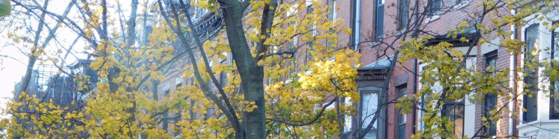
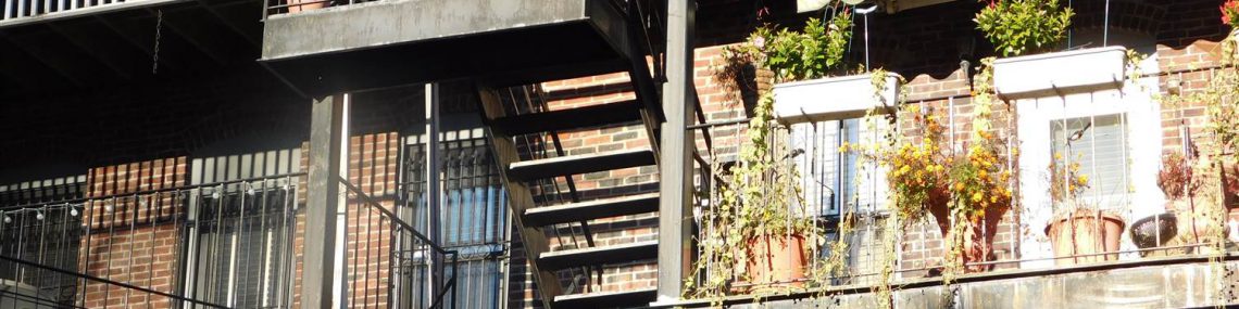
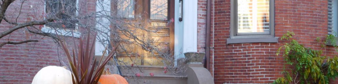
You are now in the historical part of the South End with rows of Victorian houses and brick pavements raised by roots of trees.
D: From there, several choices to reach the…, your next stop. The route indicated on the map is one possibility among many others as all the small streets of the district have their own charm.
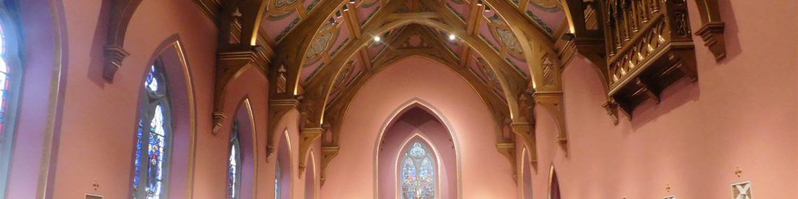
This cathedral, the largest catholic cathedral in New England, could be coming directly from Europe. Its imposing interior gives way to more intimate chapels at its far end, including the one on the left with its warm and attractive light.
After exploring the place, take … on your right to go to …
E: You are now in the .. district, a set of old pianos, shoes and canning factories transformed into residential buildings in the 2000s. It’s known for its restaurants and galleries.
At …, on your right, you will find a way to these galleries and many artists’ studios. Every Sunday in season, there’s a fruits and vegetables market and another one dedicated to arts and crafts.
F: When …. joins …, turn left to … Once there, you’ll see another garden facing you. Turn right in front of it to find .. on your left; then reach …
As an option and not on the map but easy to find, once at…., turn right to get to …t. Then turn left and once at the next block, cross …to find …, then … and their big and colorful murals. Then come back following the same way to get to the walk indicated on the map.
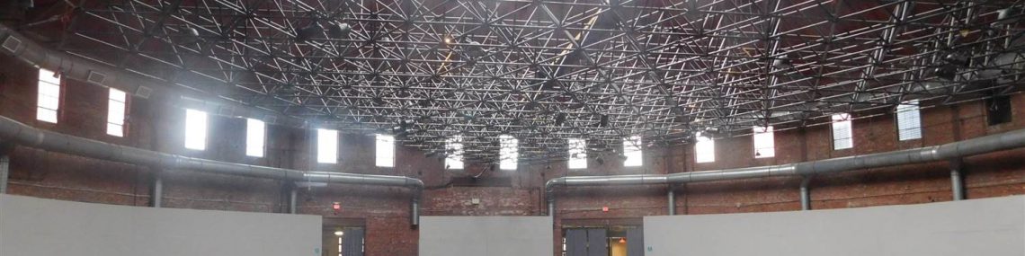
G: In front of you, the …a, a building now run by the Boston Art Center. Originally, it was a place where you could admire a cyclorama from the Battle of Gettysburg. It was later converted into a carousel; a cycling track; a boxing room; then an industrial area.
Go and see its dome, one of the biggest in the country; imagine what it has seen over the years.
H: Get out on …; depending on your preferences, stay on this avenue or take a series of small streets as indicated on the map to go to …
From there, find … a street cut in the middle by a minuscule park carefully maintained and decorated by a local association. It is lined with rows of red brick houses, themselves well decorated in any season. It’s the reason why you took this detour.
I: Stay on … direction …, until you get to a pathway interspersed with flower beds.
Take it on your left to reach … and the T.stop of the same name. Push a little further and you’ll come back to your starting point, point A.
From there, you’ll be able to find the start of Walk in Boston # 16.
Convinced that this walk will be exceptional? Find it on Payhip.