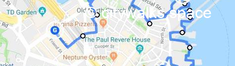
Walk in Boston # 2, the other North End, is a self-guided 2 miles tour in a quiet section of the North End. You will discover a part of the Italian neighborhood which is not on the usual route, far from the crowds and along the sea.
It is now only available on Payhip in pdf format with a clickable map and updated descriptions.
In this pdf you will also find:
- the list of Highlights.
- the Metro stops to get there and back and infos for Cars.
- tips about restrooms, places to sit and eat.
- details about a particular place you will find on your route.
You can download it (or just the map of the walk) to your phone to help you in your discoveries.
This will then allow you to live a unique experience of the city far from what you might find elsewhere.
If you purchased the Boston NYC book, this download will be free for you, just send me a note for an access code for this walk if you don’t have it already.
The description below, incomplete and with cropped photos, gives you an idea of this walk before you decide to buy it.
A: Your trek starts at…
At the bottom of the stair, in front of you and on the other side of the street, the…, a very powerful work of art. It’s made of six glass towers under which you may walk and read what they symbolize, amid steam rising from underneath.
Take…
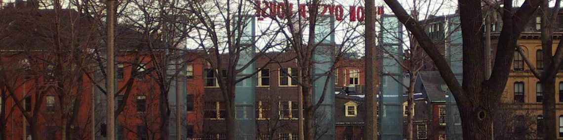
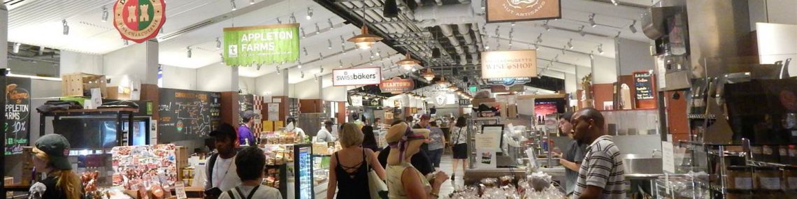
On Fridays and Saturdays from dawn to dust, you’ll be able to buy the cheapest produce in the city at the … It’s an open air market said to have started as early a the 1600s, and more officially around 1830. Its name comes from the hay farmers were selling here at the time.
If you have a picnic in mind, small brick and mortar food shops on…, will allow you to add variety to the fruits and vegetable sold at the market.
Alternatively, the …, home of local producers, and open from Wed to Sun or 7/7 in summer, will satisfy your needs. Otherwise, wait a little bit until you reach a well stocked Italian grocery shop.
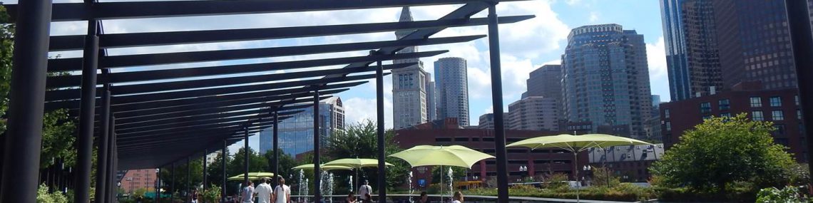
B: Cross now…toward the…, a good place to eat the food you just bought. You’ll have views of Downtown Boston and a never-ending flow of people. With a bit of luck, you’ll even find tables and chairs available.
Before 2007, ..was the location of the Central Artery, an elevated highway built to alleviate traffic congestion in the city. When it became obvious it was creating problems of its own, and cutting the city in two, plans to built a tunnel emerged.
The project was nicknamed “the Big Dig”, took ten years of planning and nearly fifteen years of construction; it was the most expensive and technologically challenging highway project in the USA. The result on the surface is now a series of gardens, public art, plazas and tree-lined promenades for all to enjoy.
C: Follow …to see some always changing public art on the right (or on the left depending on the side you took); then “…park. It’s not the best part of the trek as it is along a busy road, but you’ll have unique views of downtown Boston to compensate.
D: Once you see … on your left. It’s a large and somewhat austere street, even though it’s lined with trees. You are in a residential section of the North End; you took this street for a mouth-watering convenience store you’ll see at one point. You’ll also find tables and chairs next to it (and they were some on your way to the store).
If you go a little further,… you’ll reach the…; at the end of the parking lot, there will be benches and tables in front of the sea.
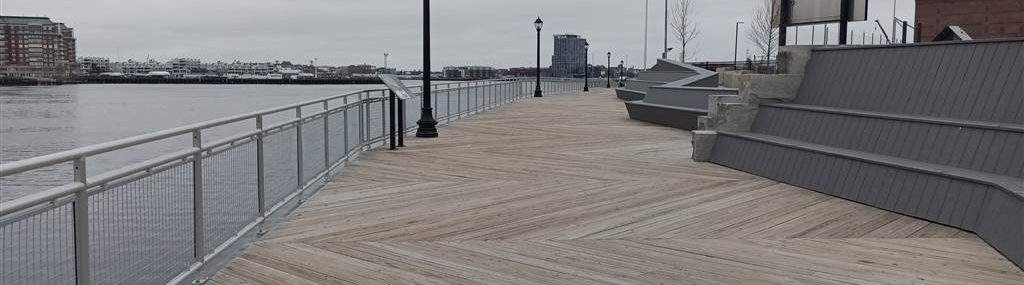
The… is a fairly recent addition to the city history; you can now walk nearly all around Boston by following it (a 40 miles trail).
E: For now, keep walking along this section of it, or take a shortcut by ….. Your goal: …, named after a failed attempt to make it a shoreline gun emplacement.
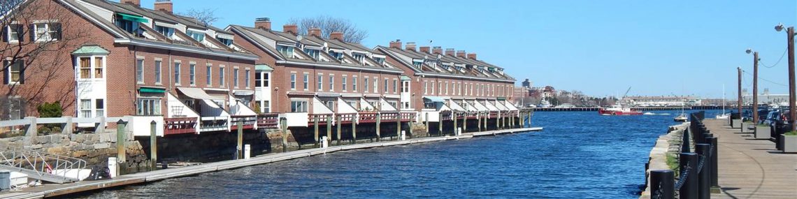
Most of the wharfs are now quiet rows of luxury apartments or hotels with panels here and there telling you their history.
At …(if it is open as it’s not always the case), you’ll find a small … with an observatory deck on the second floor. It will transport you to the time of whale oil processing and sailing ships building. You’ll realize how busy this part of the North End was at one point.
Next to it, you’ll see …, some small, some impressively big, with East Boston on the other side of the harbor. Here again, some panels will tell you the history of this station, one of the oldest in the USA.
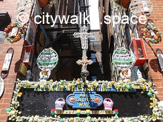
For security reasons, you won’t be able to enter it, so go back to … in front of you. Just before reaching …. on both side of the street, you’ll see unusual religious decorations.
Cross …, a quiet street with alleys here and there.
At … turn right and on the other side of…. It’s open to everyone in season, fairly cheap, with views of the harbor.
Otherwise, you can also keep walking a little more on …; then take the stair going down just before ….
F: From the …, you’ll find a path that will bring you back to the Harborwalk.
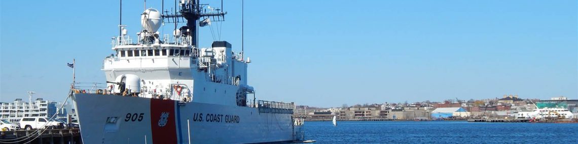
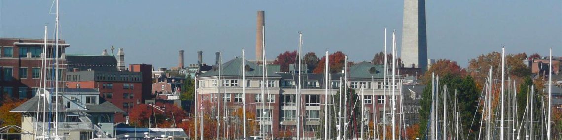
There you’ll see locals playing bocce, strolling along the sea, jogging, or just sitting on benches and talking. There is Charlestown on the other side of the harbor, the SS Constitution and USS Cassim Young at dock, and Bunker Hill on top.
G: It’s possible that the… as there’s construction on the new Charlestown bridge. If it’s the case, go back to …. by turning left after the modern school on your left, instead of going straight on.
Take…. on your right, then…. (the next one) on your left.
The idea is to follow a few small streets in this non-touristic part of the North End to reach … then to turn right to reach …to cross it toward … on the right to go to …
Otherwise…), keep following the …
You’ll go under the… see the Zakim bridge on your right and …on your left.
It’s easy to find your way to the station, but difficult to explain it, so trust what you see.
Once at.. you’ll be at the end of this trek!
If you want to walk more, you can now start the Walk in Boston # 5, the historic Charlestown (in that case, no need to go to the station), or the Walk in Boston # 1, the forgotten West End.
Convinced that this walk will be exceptional? Find it on Payhip.